Trail Walking Les Premiers-Sapins - chasnans - Photo
© OpenStreetMap contributors
Length
Length
7.9 km
Max alt
Max alt
825 m
Uphill gradient
Uphill gradient
157 m
Km-Effort
Km-Effort  
9.9 km
Min alt
Min alt
737 m
Downhill gradient
Downhill gradient
154 m
Boucle
Boucle
Yes
Creation date :
2021-06-11 11:44:14.734
Updated on :
2021-06-12 18:20:30.42

(0 Reviews)

Walking
Walking
1h35
Difficulty : Very easy

Scan this QR Code to open this trail in the SityTrail application

FREE GPS app for hiking

Logo SityTrail SityTrail

IGN / Geographical institutes

Download SityTrail from the App Store Download SityTrail from Google Play

Logo SityTrail SityTrail World

The world is yours!

Download SityTrail from the App Store Download SityTrail from Google Play Download SityTrail on Huawei AppGallery

About

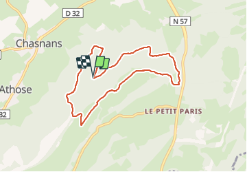
Trail Walking of 7.9 km to be discovered at Bourgogne-Franche-Comté, Doubs, Les Premiers-Sapins. This trail is proposed by eltonnermou.

Description

parking : baraque de chasse de Chasnans
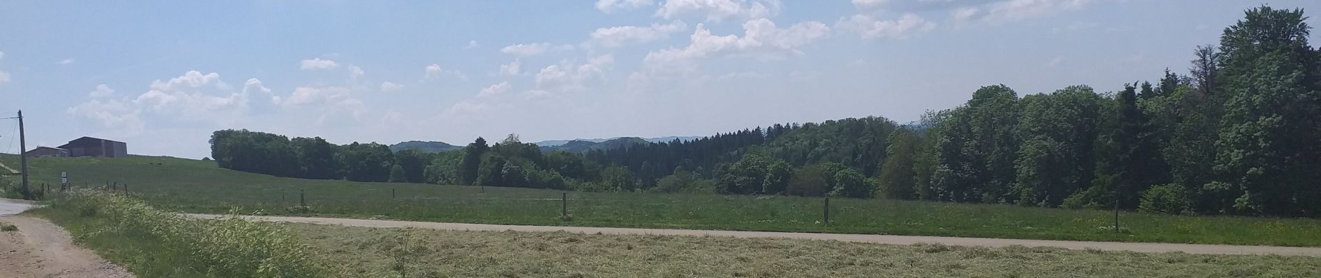
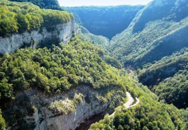
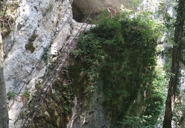
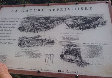
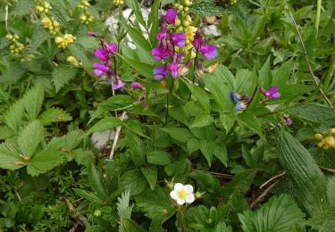
A travers bois et de belles prairies,  flore protégée et variée ; des points de vue qui réchauffent les yeux ; un dénivelé qui ne peut faire peur, malgré le petit coup de cul entre 2,6 et 3 km. Nous traversons le domaine des chevreuils, à vous de vous laissez surprendre ....

Elevation profile

Photos

Positioning

Country:
France
Region :
Bourgogne-Franche-Comté
Department/Province :
Doubs
Municipality :
Les Premiers-Sapins
Location:
Chasnans
Start:(UTM)
297232 ; 5217595 (32T) N.

Trails nearby

Trail Walking Mouthier-Haute-Pierre - Roche de Hautepierre (881 m) - Photo
Walking
tracegps

Walking

Difficult
(1)
Mouthier-Haute-Pierre, Bourgogne-Franche-Comté, Doubs, France
11.6 km | 19.1 km-effort
4h 30min
Yes
Trail On foot Mouthier-Haute-Pierre - Mouthier Haute Pierre - Photo
On foot
grasgilbert

On foot

Medium
(1)
Mouthier-Haute-Pierre, Bourgogne-Franche-Comté, Doubs, France
14.1 km | 23 km-effort
5h 11min
Yes
Trail Walking Mouthier-Haute-Pierre - Mouthier Haute Pierre 21 juillet 2020 CAF - Photo
Walking
TRIMAILLE

Walking

Very easy
Mouthier-Haute-Pierre, Bourgogne-Franche-Comté, Doubs, France
20 km | 32 km-effort
6h 51min
Yes
Trail Walking Mouthier-Haute-Pierre - source de la loue - Photo
Walking
phileasy

Walking

Difficult
Mouthier-Haute-Pierre, Bourgogne-Franche-Comté, Doubs, France
17.9 km | 27 km-effort
6h 58min
Yes
Trail Snowshoes Arc-sous-Cicon - ARC SOUS CICON
Snowshoes
legios84

Snowshoes

Easy
Arc-sous-Cicon, Bourgogne-Franche-Comté, Doubs, France
9.4 km | 12.9 km-effort
2h 41min
Yes
Trail Walking Les Premiers-Sapins - hautepierre - Photo
Walking
Delmasjacques

Walking

Very easy
(1)
Les Premiers-Sapins, Bourgogne-Franche-Comté, Doubs, France
3.6 km | 5.9 km-effort
1h 59min
Yes
Trail Snowshoes Les Premiers-Sapins - rando raquettes Nods  - Photo
Snowshoes
mig26

Snowshoes

Very easy
Les Premiers-Sapins, Bourgogne-Franche-Comté, Doubs, France
11.5 km | 0 m-effort
4h 26min
Yes
Trail Walking Les Premiers-Sapins - 2013-12-21(Charmeux) - Photo
Walking
patricerouge@free.fr

Walking

Easy
Les Premiers-Sapins, Bourgogne-Franche-Comté, Doubs, France
4.8 km | 6.5 km-effort
1h 20min
No
Trail Walking Arc-sous-Cicon - rando le mont pelé  - Photo
Walking
mig26

Walking

Easy
Arc-sous-Cicon, Bourgogne-Franche-Comté, Doubs, France
15.8 km | 23 km-effort
4h 21min
Yes


Close
My subscriptions